
Machina 001
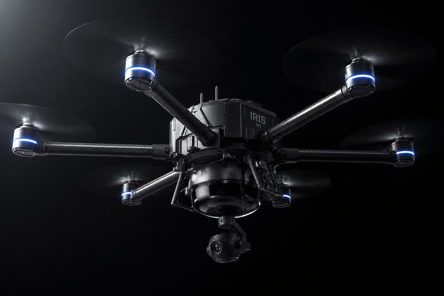
IRIS V1
Autonomous Survey Hexacopter
60min
Flight Time
3.5kg
Sensor Payload
±1.5cm
Accuracy
Capabilities
The first machina in
every NEXUM deployment.
Autonomous Site Survey
Executes systematic aerial survey patterns across complex terrain. Generates full 3D site models at ±2 cm accuracy without operator input.
Real-Time NEXUM Uplink
Streams telemetry and processed site intelligence to NEXUM during flight. By landing, the deployment plan for ground machinae is already computed.
VECTOR Deployment
IRIS V1 is transported to site by VECTOR and launches directly on arrival. Logistics are fully handled — IRIS V1 is optimized purely for site operations, not transit.
Task Handoff
On mission completion, IRIS V1 triggers next-phase machina deployment. No human instruction required between survey and ground operations.
Specifications
Full spec sheet.
Designation
IRIS V1
Configuration
Autonomous Hexacopter — 6-rotor
Max Takeoff Weight
12 kg
Rotor Diameter
1.4 m (total footprint)
Cruise Speed
45 km/h
Max Flight Time
60 min
Operational Range
2 km (site coverage)
Service Ceiling
120 m AGL
Payload Capacity
3.5 kg
Mapping Accuracy
±1.5 cm GSD (RTK GNSS)
Motor Redundancy
Continues operation on 5 of 6 motors
Onboard Storage
512 GB encrypted
Connectivity
5G LTE / 900 MHz mesh / Iridium
Deployment
VECTOR machina — field launch
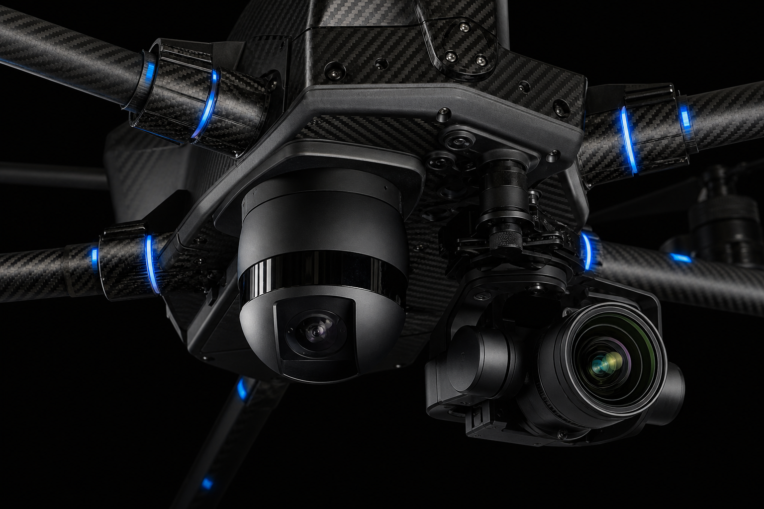
Sensor Suite
Eyes that see everything.
01
LiDAR
1M pts/sec — 360° hemispherical field of view
02
RGB Camera
61MP — 3-axis stabilized gimbal
03
Thermal
FLIR Boson 640×512
04
Multispectral
5-band — vegetation, soil, and moisture analysis
05
GNSS
Dual-frequency RTK — ±1.5 cm accuracy
06
Ground Sensor
Acoustic soil density probe — deployed on landing
NEXUM Integration
The mission starts
before it lands.
IRIS V1 does not return with data and wait for instructions. It streams processed site intelligence to NEXUM in real time. By the time it touches down, the deployment plan for every ground machina is already computed and ready to execute.
When IRIS V1 identifies conditions that change the plan — unexpected terrain, material conflicts, safety concerns — NEXUM updates the downstream task graph in real time. No delay. No human in the loop.
IN FLIGHT
Streams LiDAR + RGB to NEXUM every 2 seconds
ON COMPLETION
Triggers NEXUM to begin ground deployment sequence
POST-MISSION
Archives full site dataset. Updates digital twin.